


Embedded maps, three levels of GIS integration
bluebee® cloud is designed to meet the needs of multisite and geographically dispersed operations, with a strong mobile component, bluebee® “for the worker of tomorrow”, to support technicians working in the field.
From its first release in 2011, bluebee® cloud naturally featured embedded maps, an integrated GIS (Geographical Information System), allowing users to display and manage spatial data related to facilities, equipment and networks, incidents and work done, as well as workers.
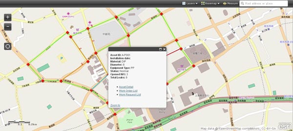
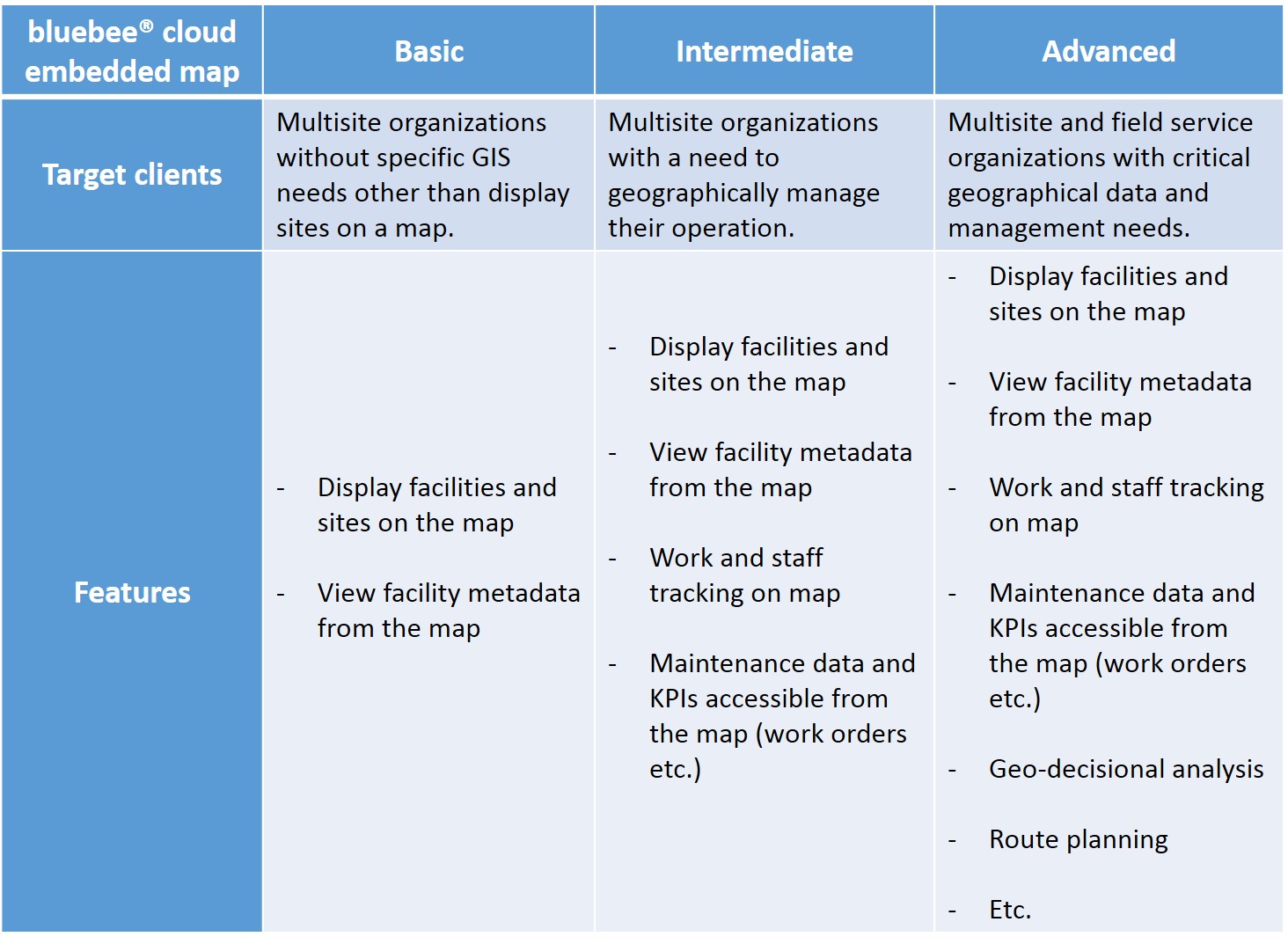
Based on Esri ArcGIS technology – the leading technology on the market – bluebee® cloud provides three levels of embedded maps. The “Basic” embedded map is available off-the-shelf as a standard product to display facilities and equipment on a map. It can be upgraded to an “Intermediate” version, offering with more comprehensive functionalities for management needs – Work Orders, Job Requests. For more “Advanced” needs, the GIS functionalities can be tailored based on specific demands.
For large complex needs (“Advanced”), in addition to Esri’s ArcGIS, bluebee® cloud can also use open-source GIS or integrate with existing solutions. Contact us to discuss your specific needs.
Now, the entire Siveco product line includes GIS maps, as the Coswin CMMS also features GIS capabilities since version 8.3. Also based on Esri technology, Coswin’s GIS allows you to display facilities and equipment on a map, the equivalent of the Basic embedded map in bluebee® cloud, with similar extension capability.
To build the standard embedded map package and to support GIS-based development, Siveco has partnered with MobiGIS since 2010. MobiGIS is a certified Silver ESRI Partner and won the Best ArcGIS for Desktop Based Application at the 2014 Esri Partner Conference. A joint Siveco & MobiGIS team is based at the Siveco Shanghai office, as part of the Siveco China R&D center.